First run
The app is available exclusively for iOS at the App Store. When you first open RIDS, it may ask you for authorizations to access to your location and to send you notifications. Just go ahead and accept those. Read the section "About Notifications and Location Services” following at the bottom for an explanation of your options if you care to know more about those.
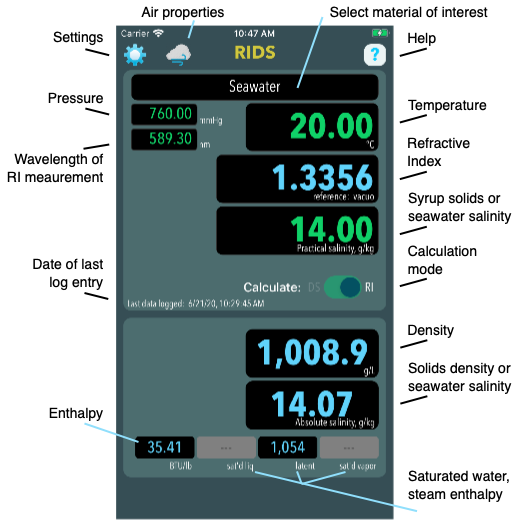
The Main screen (in Dark Mode, iOS 13 and later).


Settings and Controls
Units of measure in RIDS can be selected by the user. These are all accessible from the Main screen by clicking the “Settings” icon in the upper left corner and are described here in the order they appear.
• Units
In this section, choose the units you prefer for temperature, pressure, density and so on. The selected unit appears on the left hand side. The final entry under “Units” is the preferred reference for refractive index. Common references are vacuum and dry air at 10°C and 1 atm (the latter is used by the CRA). Air at user-chosen ambient conditions is also available.

Here you can send an email to the developer that includes some log information recorded by the app itself that may help diagnose any problem you are having.
When you make certain data entries into RIDS, the inputs and calculated results are recorded in a log file. This frees you from having to write down results as you process data.
The log file is a rolling 1Mb record. Data will accumulate until the log file reaches 1Mb. It is then archived and a new file begun. When the new file reaches 1Mb, the older archive is discarded, a new one created with the latest data, and a new log begun. The log files may be emailed directly from within RIDS. They can also be accessed using the Files app on your phone.
• Location
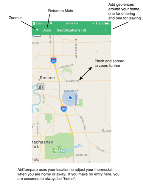
There is only one calculation in RIDS that requires location information: The TEOS-10 formulation can estimate local seawater salinity based on latitude and longitude. For convenience RIDS can acquire the user’s location and offer this as the location used for calculations. The user can choose to accept or select another location.
Setting the geofence tells RIDS the coordinates to provide the TEOS-10 formulation. I’m not sure how it calculates salinity for locations on land, but it does.

(This view has since changed slightly to simplify setting your geofence.)
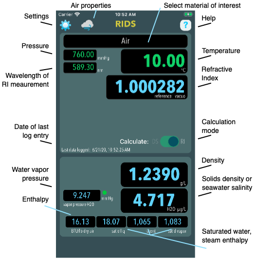
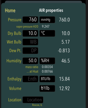
The “Air” screen
RIDS contains the full psychrometric calculator also built into AirCompare and it can be accessed on this screen.

About Notifications and Location Services
When you first open RIDS, it will ask for your authorization for these two items. Here is an explanation of your options. Note that you can change your choices at any time in your iPhones Settings:
Settings>Notifications>RIDS (suggested setting: all switches “On”)
Settings>Privacy>Location Services>RIDS (suggested setting: While Using)
Why does RIDS need access to these services?
Notifications
You can use RIDS without notifications if you choose. RIDS saves your settings and log files to an iCloud backup if possible. This allows your data to be shared between multiple i-devices running RIDS. If you change the settings on one device, other devices are notified of the update. This requires each device to enable notifications. [I believe RIDS will fully function without notifications enabled].
Location Services
You can use RIDS without Location Services. There is only one calculation in RIDS that requires location information: The TEOS-10 formulation can estimate local seawater salinity based on latitude and longitude. For convenience RIDS can acquire the user’s location and offer this as the location used for calculations. The user can choose to accept or select another location. With Location Services disabled, you will not see your current position as you choose a location for the calculations. [Need to experiment here to see what happens]
